Working in a developing country to teach geography faculty new skills with GIS towards a new digital geographic resource for Ethiopia has been truly an honor. I have realized how different and difficult this task really is.
Typically, workshops that come to Ethiopia or to other developing countries are right out of the box, often in a controlled environment and at a location that has tremendous support staff. We have none of this – and it is so tremendous. In fact, there is so much awesomeness about this week so far that I can hardly contain myself. We have tried to tailor this work shop to focus on development. Development in a developing country – nothing new right? Wrong – we are focused on academic development. My colleague Johnathan and my student Emma and myself have tailored this workshop to consider each participant skills and interests in geography and match those with the product of collaborative efforts to begin building a national atlas that can be used for curriculum geographic knowledge. I have met some amazing Ethiopian geographers! The last few days I have only gotten about 11 hours out of 72 in sleep, but it has been so worth it.

Serious GIS data crunching and data creation!
 My favorite driver in Bahir Dar.
Bus stop in Bahir Dar
Ethiopian geographers are so challenged in many ways. One of the biggest is data poverty. There are lots of types of poverty and data poverty is one of them. Ethiopian geographers are not able to work with geographic data because they lack significant access to it. I and others have been working to eliminate that problem and over the last year have built and extensive geospatial database for the geography Ethiopian faculty to use with GIS. The last two days has been brilliant! Seeing my colleagues light up with joy as they explore their country with relevant, meaningful, and detailed data at the Woreda level is beyond words. I have engaged with them in many ways and it has been a real privilege to work side-by-side in collaboration to change the ways GIS and geography are taught in Ethiopia. Johnathan will continue the work after Emma and I leave this Saturday.

Sweet!

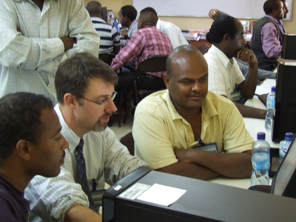
Discussing data and map creation assignments

Creating a 500 meter interval contour of the whole of Ethiopia on a 20 meter resolution DEM

Mastering GIS!
GIS data exploration with NDVI and RFE2 precipitation data
. There is still so much to do in academic training, skill development, pedagogy, and friendship. I meet with the university President tomorrow. He indicated that he wants to hire two new GIS geography faculty and wants to ask for advice about candidates. ANDREW QUACKENBUSH, would you be interested in Bahir Dar University Geography as a faculty member?
No comments:
Post a Comment